Monday, December 27, 2010

Summit Lake Alaska

I have found winter and spring are my two favorite seasons because I get to surf the gnar! I try to go out nearly every weekend for a quick skin and ride. There is no better therapy for, 'winter blues' or 'work blues' in my case.

For Christmas, I was blessed with a helmet cam. A much needed winter gadget that will help in sharing my passion for riding the mountains. I don't tend to take many pictures if any in the winter, mostly due to colder temperatures, bulky gloves and the fact that I lost our point and shoot last winter.

I was able to use this newly acquired technology on a short day trip out near Summit Lake, Alaska. I didn't take the time to edit the clips, so, turn on your favorite tune and enjoy the few minutes of me, surfing the gnar.


Saturday, October 9, 2010

Past Works

Here are a few projects that I have done in the past.  All the pieces have been finished though the pictures may not show the finished product as I wasn't into taking too many photos at the time.


Maple Countertops


Tigerwood Bassinet.  A piece I made for my daughter and one that I hold with pride.


Tigerwood and Brazilian redwood checker board


Tigerwood and Brazialian redwood cribbage board


Large, too large, birch plywood bookshelf


Fir full-size bed w/storage

Sunday, September 19, 2010

Peters Hills to Tokositna

I wanted to do one last trip this season while the fall colors were still out.  We would hike Peter Hills, located south of the Alaska Range, 130 miles north of Anchorage.  If the weather was nice, it would offer fantastic views of Mount Hunter, Denali, and Foraker as well as many others.  After hiking Peter Hills we would float the Tokositna River which flows east out of the Alaska Range and joins with the Ruth River before merging with the Chulitna River.  Our take-out point is where the Chulitna River intersects the Parks Highway.

To do this trip like most others required a shuttle, so I needed a trip partner.  I recruited a co-worker, David Juran.  I called him and described the route; twelve miles of hiking and thirty miles of floating in two days.  Now, he had never been in a packraft and hadn't even been in Alaska for more than six months, so of course he accepted with naive excitement.  Dave is a great guy and enjoyable to be around with his child-like humor, so I was looking forward to spending a couple days outside of work together.


We parked Dave's truck at the Chulitna River bridge on the Parks Highway and headed for Petersville.  The road to Petersville is a little rough and takes about an hour to drive the entire distance to where an ATV trail leads in to the high country.  I typically get lost being on trails and this was no different, soon enough we had to backtrack, but just once.

Finally, off trail we were starting to get some distance between us and the car.  Peter Hills has several small lakes and hills to go around.  Route finding wasn't difficult but you had to take your time to find a dry route.  Never really getting on a ridge, Peter Hills, is as it sounds, hilly.  There are multiple ups and downs but nothing with much elevation gain or loss.


Nearing the end of Peters Hills, the clouds cleared completely and the views of the Alaska Range were incredible.  Unfortunately, we had to start dropping down towards Home Lake.  Not only were we leaving the grand views of the alpine but we were headed for an inevitable bush whack.


On our descent we were able to devour an abundant amount of high bush blue berries (mountain huckleberries).  I would break off a branch and eat while walking down towards the Alaska jungle.


Once in the brush we were able to break through fairly easily but as usual the lower we went the worse it got.  We found a decent game trail and followed it for a ways until it seemed to meander off in another direction.  In hindsight we should have stayed on the game trail as we wound up in the bottom of a small drainage.  More than likely the trail went around the drainage, staying high instead of going straight through it like we did.

Once at Home Lake, darkness was approaching fast and we didn't have much time to find a campsite.  Alders sloped around the entire south side of the lake.  The north side looked marshy but flat.  Confident we could find a flat, dry area across the lake, we blew up our rafts and crossed. We found just enough room in a dense forest of willows to camp and pitched our shelter with the help of headlamps.  It was arguably the worst camp that I've ever had, but it worked and was comfortable enough.


We woke early knowing that we had an all day float ahead of us.  It was a cool, crisp, fall morning and paddling down the lake through marshes we saw salmon, ducks, grebes and a pair of swans.  Coming toward the end of the lake we discovered beavers had dammed the outlet.  Approaching the dam, the beavers would swim back and forth across the channel slapping their tail and bodies with such force it looked painful.  As we were crossing their territory they mysteriously disappeared.  We could feel them watching us as we portaged the dam.

At the confluence of the Tokositna there were so many salmon their backs brushed the bottom of our rafts as we floated over top of them.  The Tokositna River, slowly meanders without rapids except the occasional jet boats that powered up and down the river.  We laid back and enjoyed the view that became better and better the further east we floated.


We took a few breaks to stretch our legs.  Eventually we passed the confluence of the Ruth and further down river had lunch at Tokosha Mtn. Lodge.  We poked around the vacant property (that is for sale for anyone interested) before heading back into the water.


Once back in the water we came upon the only rapids the river had; a short boulder garden.  Lining the boats down most of it we put in for the last set giving Dave and myself some much needed excitement and practice.  Just before joining the Chulitna River we saw a black bear swimming across.  The third bear of the trip.  The other two, a black bear sow and cub we saw far off in the alpine while hiking Peters Hills.

Once in the Chulitna, it was a fast float to the bridge.  The Chulitna was a little more exciting.  It was fast, braided, zero rapids, a little wood, and lovely views of the mountain range yet again.  At the bridge we were happy to be done with our eleven hour float and nearly 48 hour trip.

If I were to do this route a second time, there are a couple things that I would require before going again.  If you follow these two prerequisites, this would be a most spectacular and scenic trip.
  1. I would make sure the weather was as good as we had it on this trip.  This isn't a good enough trip to not have the scenery making it worthwhile.
  2. Take two nights to do the trip.  The first night you should camp in the alpine, taking in the evening and morning lighting on the mountains. On the second night camp along one of the many river bars, ideal for a campsite.

Tuesday, September 14, 2010

Nabesna-McCarthy

Nabesna to McCarthy has been on my mind for a few years now, but more so, in my trip-partners mind, Greg Hough.  He was talking of this route before I even knew what a pack raft was.  It wasn't until last year that I even considered doing this trip.  This was bigger than anything we had ever done, 150 miles in seven days.  It is one thing for us to go twenty miles in a day, but averaging that twenty miles a day for over a week is much more than either of us had experienced.  This trip tested our physical and mental strength more than anything.  We had all the skills and knowledge to complete this route, but did we have the stamina?

Day 1. Jack Creek to Cooper Creek

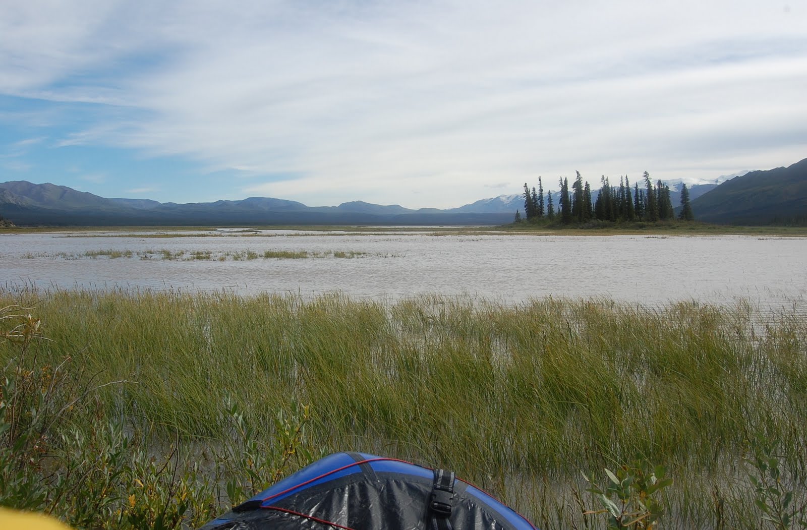
Our route starts out with a short half mile hike to, Jack Creek, where we put in for a slow meandering float before joining the mighty Nabesna River and taking out at the confluence of Cooper Creek.

Jack Creek is a clear water stream with few obstacles.  A few sharp turns and a little wood in the river keeps it interesting for the first few miles but then slows down and oxbows towards the Nabesna River.


Coming upon the Nabesna we take-out to take a few photos and see what we're getting ourselves into.  Much to my surprise it appears fairly straightforward.  The main channel is intimidating with its powerful current, but wave trains and rapids are nowhere to be seen except for where the river runs close to some bluffs that are easily avoidable.


We take-out at the confluence of Cooper Creek, find camp and cook dinner and prepare ourselves for the second day.

Day 2. Cooper Creek to Notch Creek

We learned something on this day, this is BIG COUNTRY.


Hiking up Cooper Creek is easy, straightforward but painful on the soles of feet and knees. Twelve miles of cobbles later and missing the drainage to access the route to Blue Lake, we were spent. But we made it to the pass where the views of the peaks 8,000 feet and higher were spectacular. 


Motivated to be traveling downhill and on tundra rather than large cobbles we went another easy six miles or so onto Notch Creek.  Where we met cobbles again but the smaller size rocks were a relief. The water on the Notch Creek was high, muddy high, so we knew tomorrow we would most likely have a chance to float a creek not usually floated.


Day 3. Notch Creek to Chisana

After the usual instant oatmeal breakfast and watching the sheep that we saw from the night before, we had a quick two mile walk down to the confluence of Notch Creek and William Creek. We put-in here feeling that there was enough volume to the creek. With plenty of water, big country, and blue skies, needless to say we were having fun. Twice as fast as walking if not more and easy on the feet.


We took out at the confluence of Cross Creek, did a few creek crossings and found the horse trail that lead to the Chisana River. The Chisana was our next big obstacle before we could stay in the public use cabin in the small community of Chisana.


The Chisana River is another large glacial river flowing out from the Wrangells. As we first came out of the woods off the horse trail and saw this large river, my spirit dropped somewhat. It did not look like fun. It looked like endlessly deep channels across a large river valley. Now, these weren't fast flowing but we were both feeling tired from the slog the day before up Cooper Creek and to see this large, large country before us we felt intimidated.

"Just keep going," I said to myself and Greg.


The first channel was the widest and deepest. We crossed it easily and crossed several more. Then something happened, I noticed how much fun I was having! We were in a huge river valley. The walking was easy on the sandy river bars, an Eagle was perched in a tree on one of the islands, there are these massive mountains all around, horses were grazing far off in the distance and we were walking across in dry suits and pulling our rafts.


We were having a good time in the biggest country we'd ever been in. We made our way into the town of Chisana, crossed two runways, located the cabin and crashed after an eventful day.


Day 4. Chisana to Solo Mtn.

With a little direction from one of the locals we made our way out of town and onto yet another riverbed, this time it was Geohenda Creek. We would follow this up for ten to twelve miles and then another six miles on a horse trail to Solo Mtn Cabin.

The walking up Geohenda was easy. By this time I think we had grown accustomed to walking cobbles all day and anything had to be better than going up Cooper Creek. More large mountains were coming into view and seeing a big bull moose was the highlight of this stretch.

Enthusiastically reaching the alpine for what we thought would be a quick six miles we began even easier walking on a horse trail. Big, glacier capped mountains to the west and Solo Mountain in the fore ground we were walking in auto drive, when I was startled by a "whoof." Not thirty yards away a black wolf jumps up from his late afternoon nap and takes off running away from us.  Once on the other side of a ridge the wolf begins to howl.  Since we were not seeing much wildlife, seeing that wolf so close made our day and trip.


Once at Solo Mtn cabin we read the log books, the walls of the cabin also had various writing, watched the sunset over the valley of the White River, and ate a meal before bed after yet another great day and relaxing evening.


Day 5. Solo Mtn to Russel Glacier

Since the start of the trip we had been gradually slowing down. Unaccustomed to the long days it was now beginning to show. Greg's enthusiasm was disintegrating. He had mentioned the previous day that he didn't know if he would be able to finish the trip, due an aggravated knee. I gave him some encouragement and we kept going, but the thought of him quitting was still in the back of my mind.  Still, all-in-all, I was confident we'd prevail.

On this day we woke up late, easy to do in a dark cabin. Starting out at eleven we knew Skolai Pass would be out of the question for today. Getting across Lime Creek was the goal.

We were easily making way on the pack trail. It would come and go but we would always pick it up again. The clouds that rolled in from the night before were obscuring the scenery but looking out to the large valley where the White River flowed was magnificent enough. Getting closer to the valley we lost the pack trail and bushwhacked our way across and then down to Lime Creek.


Getting to the river and wanting to keep the momentum going, thinking there might still be time to get to Skolai after all, I impatiently picked my way across Lime Creek. I managed to pick a descent route but I had one channel left. At this point Greg started to follow my route. He watched as I searched up and down the bank for a way across the largest channel yet. I started across, the force of the river was pushing me down stream even though I was well-balanced. The longer I stood still, the more the river would erode the rocks out from underneath my feet. By this time the water was up to my waist but didn't look like it would get any deeper or stronger. Not wanting to loose my balance by switching directions I committed to the crossing and made it! What a relief and what was I thinking? Greg, the more cautious one, blew up his raft, as I paced back and forth, shivering on the river bank.


Warmed up again by the walking towards Russel Glacier, we discussed whether or not we should continue on to Skolai Pass. We eventually came to a decision not to go.

Day 6. Russel Glacier to McCarthy

Waking up on this morning I had an anxious feeling to get moving. We had a long day ahead of us. In order to stay on pace we had to make it over Skolai Pass, across the Goat trail, across the Chitistone River and down stream from there. Then the following day, put in and float most of the way to McCarthy and hike the rest. We can still do it I thought, but I noticed the enthusiasm to finish the trip had vanished from Greg. I threw everything I had at him and got the day going. "Lets just get to Skolai and we'll see," I encouraged.

We headed out unaware of the rough conditions ahead. The hike along the moraine beside Russel glacier was easier than I had imagined, until we approached Lower Skolai Lake. Mudslides had exposed the glacier in some portions along the route. We had to navigate mud holes that looked as if they would swallow us whole. Once across my excitement grew as we hiked alongside the lower lake.


It was somewhere in between the lower and upper Skolai lakes that Greg said he wouldn't be able to go any further than Skolai Pass. With disappointment, I blew off some steam by hiking far and fast ahead of Greg. Giving myself time accept that the trip was over we met again along upper Skolai lake.


Along our way to the airstrip we called in and luckily we were able to get picked up late that afternoon. We gorged ourselves on some extra food that we wouldn't need anymore and had a most enjoyable flight to McCarthy.

Once in McCarthy, we ate a good meal, drank and heard some great Alaskan music. Then a final walk back to the truck without any packs or resentment. It was a great trip!

Sunday, August 22, 2010

Bomber Traverse

At the beginning of summer I received news that Leisha, my sister-in-law's sister was making her way back up to Alaska. As I knew Leisha was the adventurous type, I wanted to take her and her boyfriend, Jacob, out on a backpacking trip.

The 'Bomber Traverse' immediately came to mind.  As it is a short hour and a half drive north of Anchorage in the Talkeetna mountains.  I have always been fond of the Talkeetna mountains and this seemed like the perfect trip for Leisha and Jacob. It offers some non-technical glacier travel which always excites out-of-towners and I had never done this route though it has been on my list for a while now.

The trip started out on Friday, August 6th, the day our nephew, Tylus Morgan Jabaay, was born.

I took off from work a few hours early so we could beat the traffic heading out of town.  First we had to drop a mountain bike off at the Reed Lakes Trailhead to help with the shuttle at the end of the trip.  Then we drove to the start of our adventure: Gold Mint Trailhead.

The plan for the day was to stay at the 'Mint Hut' approximately nine miles in.  Leaving the truck at six o'clock with loaded packs and not knowing exactly where the hut was didn't give us much time. Not only were we getting a late start, but the sky was overcast with a ceiling around 3,500 feet.  The trail was supposed to lead straight to it so there was no immediate need for concern.


Around mile five the vegetation started closing in on the trail and rain gear was dawned to avoid getting soaked by the rain saturated brush. 


A few miles later, wet, cold, and dark we started the push upwards toward the hut. Somewhere around this time I lost the trail and started traveling south around a large bench.  Later realizing we should have been on the north side of this bench where the hut would be located. After wandering around in the dark for far too long we set up the tents and bedded down for the night.


In the morning we awoke to partial clearing, but fog and clouds were rolling in and out. Jacob and Leisha went for a morning stroll to find water for some delicious banana-strawberry pancakes (thanks to Leisha) and they caught a glimpse of Mint Glacier and Montana Peak. After breakfast we headed upwards for 'Backdoor Gap' a small pass that would gain us access to our first glacier.


Once at the base of the pass, we looked up to see nothing but clouds. This didn't make us feel too confident but a quick glance at the GPS reassured us that we were traveling in the right direction. Making it to the top we enjoyed the gradual improvement of the visibility on the glacier.


Traversing across the glacier heading towards our next destination, 'Bomber Glacier', we made a few detours around some smaller crevasses and eventually had to avoid a larger but still fairly small bergschrund to get to a small saddle which would allow us to drop down to the 'Bomber Glacier'. Still enjoying fair visibility we stopped for a snack and views of both glaciers.


Dropping down towards 'Bomber Glacier' was steep, narrow, and loose rock prompted us to descend one at a time. Once on the glacier we headed straight for the airplane crash located in the center of the glacier. Poking around for a while we left for the final leg of the trip.


The Reed Lakes Trail was our way out to the bike and eventually to the truck. We were soon clouded in again.  A quick lunch at Upper Reed Lake we were then on our way again.


A few more stops to look at the water falls, lakes, and do some blueberry foraging we made it to the Reed Lakes Trailhead where I enjoyed a fast and invigorating bike ride down to the truck.


Returning Leisha and Jacob back to Melissa's house where I met Tylus, a handsome baby boy, for the first time.