Showing posts with label Packrafting. Show all posts

Thursday, October 20, 2011

The Doubtful Goat, Chitistones Skolai, Fredrika and the Nizina


John Guthrie and I departed Anchorage, for McCarthy, September 7th to begin a multi-day backpacking trip through the Wrangell-St. Elias National Park.  It is now a month later.  I've been writing off and on and have finally finished.  This is my story:


...and if you don't want to read the long story, scroll down to the end and at least watch the video.  Here's the story:

Thrilled at our accomplishment, saddened not to still be out there, and joyed to be back at home with family.  I go back and forth between these three emotions.  Andrew McLean said it best, "When you're on an expedition, you wish you were home; when you're home, you wish you were on an expedition - that's the sign of a balanced life."  I look forward to keeping a balanced life long into the future.  Though, with a trip this grand its hard to not want to be out there still.  

The trip began with a colorful autumn drive into McCarthy, then was proceeded by a flight to the snout of the mighty Nizina Glacier.  We are dropped here, between the glacier and the mouth of Doubtful Creek. Our bird flies off and leaves us to travel by foot and eventually pack-raft, back to McCarthy.

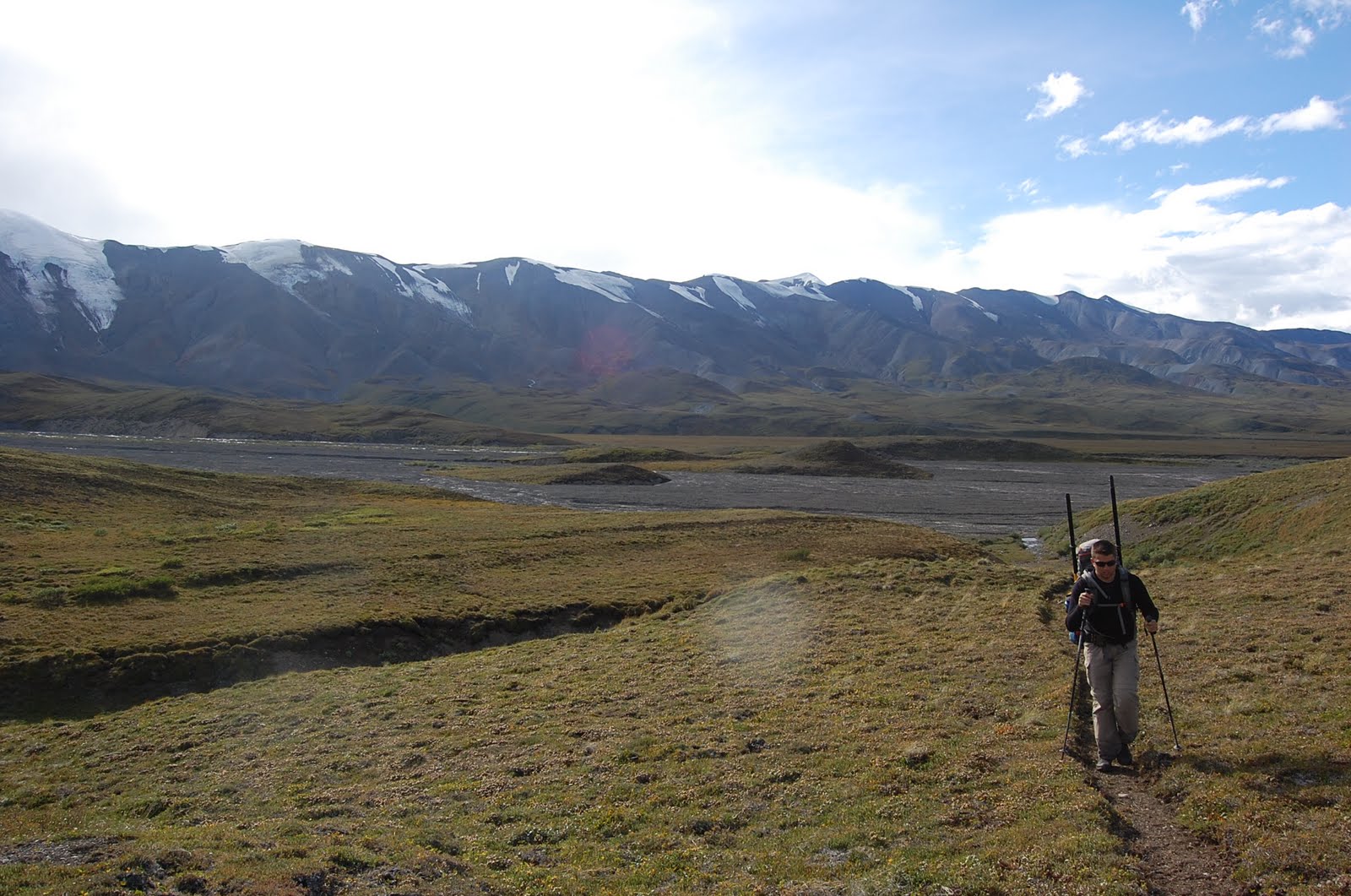
The first day of travel, was up the menacing, Doubtful Creek.  Doubtful Creek had layered canyon walls and colorful cliff bands, rock glaciers and glacier capped peaks, these were the only comfort we had to the upward stumble of this rock choked creek bed.    After the eight mile struggle on a continual upward slope of 3500 feet, we made it through the pass and camped just a few miles down.  Our campsite was near a small creek with views of the University Range.  Dall sheep grazed on nearly every hillside.

Now, on day two, we were pushing for the famed 'Goat Trail' in the Chitistone Gorge.  We walked five miles to where we would drop onto the trail's highest point.  As we walked we were accompanied by snow, sleet, and three waterfalls.  Once on the colorful cliffs of the 'Goat Trail', our eyes peer down thousands of feet to the Chitistone Creek.  We looked out across the gorge to cliff bands of similar beauty and forward to the steep trail, yet to be traveled.

I now understand why Chitistone Gorge is so prized.  The mountains are painted in green, red, orange, grey, and purple.  The colors lay horizontally and diagonally, and fan out below the chutes of cliffs to the valley below.  Snow highlights every ridge and cliff in the gorge making it more of a canvas in September. 

After a long day through world class terrain, we make camp at a tarn in Chitistone Pass.  We will stay two nights to walk the pass' many benches and have a day of rest.  With the wind howling through the pass, we were forced to cook within the shelter of our tents vestibule.

On the second evening at Chitistone Pass, I laid outside in a sleeping bag on the bank of the lake to eat dinner and gaze at the surrounding landscape.  The cold wind was moving our small part of the world that late evening.  The cotton grass seemed to shiver, while clouds moved quickly across mountain peaks, spires, ridges and saddles like a delicate fabric is brushed across the back of one's hand and fingertips.  Chitistone gave us another gift of color and visual majesty when the moon and the aurora would show its light with each break in the cloud layer.  The phenomenon appeared in an emerald green and in one instance had a champagne like edge. 

Chitistone, however, was not done yet. The fourth morning we awoke to a lone, bull, caribou.  He stood silhouetted on the horizon in the morning light, antlers towering in a grand display of prowess.  As he vanished the same way he appeared, we stuffed our gear into packs and began our descent down the pass. Just above where a creek begins its fall to the valley floor, we met another treasure from the grandeur of Chitistone; Dall Sheep, had come down from their pasture, as if to meet us before our descent.  We shared a drink of water with these trusting creatures, then we both went our separate ways.

With another moment to be ecstatic about we quickly descended to the valley floor of Skolai Creek.  Crossing this marshy valley we were happy to have had the cold temps freeze the otherwise ankle deep muck and swampy landscape.  Nearly half way across the valley we see three dark beasts with a mane of white - more caribou.  They are moving up the valley in a majestic trot.  We spooked them off their way but they are soon looking down on us from a high bench.  We move on down the valley towards the Fredrika River.

We made our way to the Fredrika, on an old trail. We cross the cold glacial river after a short bushwhack.  We make more consistent bear calls as we move through old river bars lined with willows and bear scat.  Just as another call goes out a grizzly, hearing the call, rises above a stand of willow.  As soon as he is up he is back down and out of sight, hoofing, with his exit from our presence.  After I get my heart beating again, we move on up the valley and make our camp near the toe of the Fredrika Glacier. 

Dinner made, consumed, and fire started; we again admire the stars and full moon, but this time on a cloudless night.  Watching the sky for satellites and shooting stars, a slow emergence of green appears in the sky, above a ridge, high on the Fredrika Glacier.  The Northern Lights appear for the second time this trip in a ribbon of green.  We couldn't believe this trip deserved to get any better, so we just laughed and watched the Aurora, until the show was over.

After a good nights sleep on a nice flat river bar we walked up the easy going Fredrika glacier, the easiest walking of the trip.  A few miles up the glacier we exited the Fredrika to go up 1000 feet and over a glaciated pass.  Once we were on top of the pass we could see the Nizina Glacier, the first views of it since we started our trip seven days earlier.  Feeling closer to the end we walked down hill toward the glaciers edge.  That evening, next to the glacier, we found the only camp and anticipated tomorrows walk on the Rhone and Nizina Glacier. 

The Nizina unlike the Fredrika was not so easy to travel down.  More route finding had to be put into navigating its moraines and crevasse fields than we hoped.  Soon we found ourselves being pushed to the west side of the glacier.  This was not in our best interest as we had stashed our boats on the opposite side before our trip began.  Nearing the toe we decided to exit on the west side unless we could find a way across.  Admitting our defeat prematurely, we were able to cross to the east a quarter mile from the toe of the glacier.  Tomorrow, we would boat to McCarthy; the end of our trip. 

We awoke to descent weather, but a storm was on the horizon.  After blowing up the boats and strapping on our packs, we were in the water.  Paddling in the lake, around large icebergs was incredible and reminded us how small we were in this big place.  Entering the river, the current picked up, the excitement ensued.  The water was low but also exposed more holes and rocks.  Waves splashed over our small boats.  Currents came from where large braids crashed together and tugged at us, but we endured through 30 mph gusts and pelting rain.  The weather hammered us for more than an hour but soon it subsided and the river did as well.  The river was still swift and cold but not as intense as the first several miles of the float.  We leisurely floated closer and closer to McCarthy.

Nearing the McCarthy Rd. we saw four humans on the banks of the Nizina.  They pointed us to where the road ramps down to the river bar, as this was our take out point.  We then march the road, ten miles into the town of McCarthy.

Being the end of the season in McCarthy and eleven o'clock in the evening, everything was closed, including the pub.  So, pints of ale unavailable and out of trip whiskey, we drove to Anchorage.  Delayed by a flat tire half-way down the seventy mile, dirt road of  McCarthy, we put on the 'donut' and slowly motored our way through the night, back to our lives and its adventures.

I've never been through better country.  This was a seemingly magical land.  There were surprises around every bend and roll in this area.  Crystals littered the ground while cliffs and waterfalls appeared from thin air.  The good Lord, must have took more time creating this magical area.  And it was good.

I'd like to thank John Guthrie for helping to make this trip a reality.  I don't know how he did this trip, with his larger than life pack, weighing at least twenty pounds more than mine, but he did, and much respect to him.  Also noting, his perseverance to get off the Nizina Glacier the way we had intended.


Here is the video I shot, all with the GoPro.  Take note pictures and videos rarely do justice as to the grandeur of the country.  This is no different.  The wide angle of the camera shows the size of the country but nothing replaces the eye. The video is seven minutes long, we were out there for eight days.


Wednesday, April 20, 2011

Kenai Canyon Packraft II

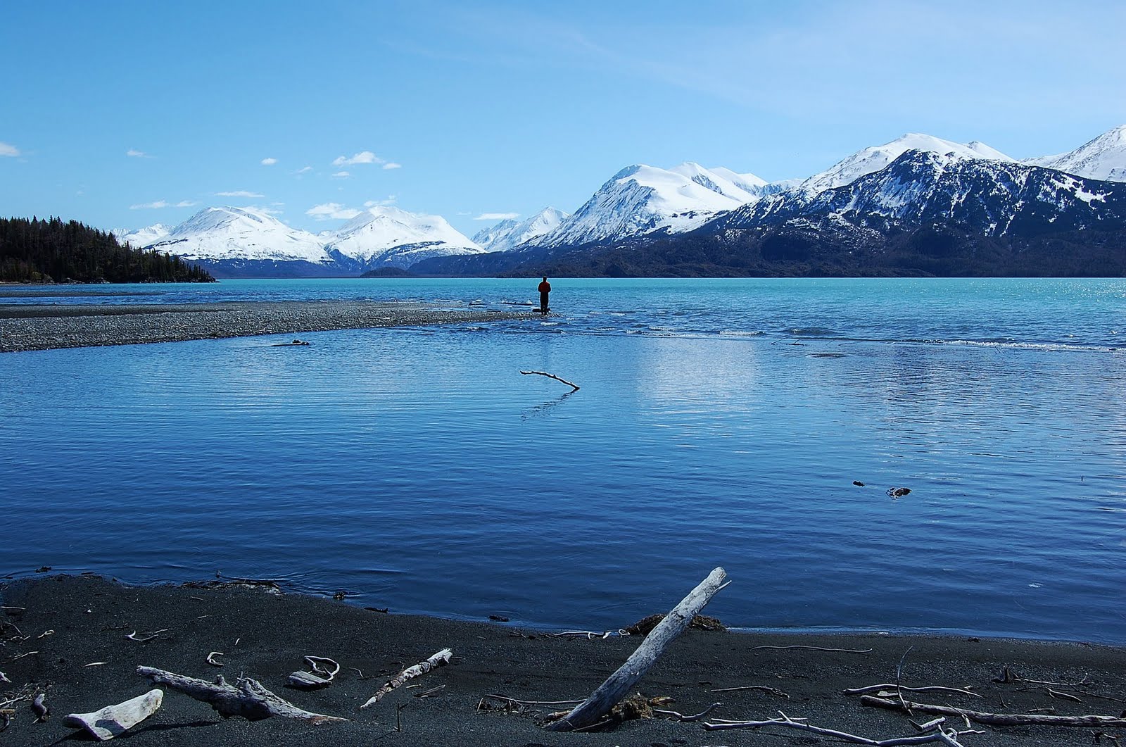
For the second year in a row me and my friend, Greg, floated the Kenai Canyon.  The water was lower than when we floated last year but the skies were just as blue.  The banks, still lined with snow, we slid in like seals and the crystal clear pools of the Kenai induced vertigo as one gazed down to see giant boulders.  Once we made it to the lake we paddled around several robust icebergs before landing on the sandy beach.  From there a quick hike through the woods and back to the truck.

While the Kenai River typically can't be visited without seeing droves of people fishing the large, sockeye salmon run, or the easy to catch, trophy sized, rainbow trout.  Early in spring, this area is vacant compared to what will be happening in a month, when the chinook salmon begin their run up-river.  I look forward to next spring when I can go back or maybe this fall after the visitors diminish.

Here's a few photos courtesy of Greg, as I was too busy enjoying my summer vacation in April.


Sunday, September 19, 2010

Peters Hills to Tokositna

I wanted to do one last trip this season while the fall colors were still out.  We would hike Peter Hills, located south of the Alaska Range, 130 miles north of Anchorage.  If the weather was nice, it would offer fantastic views of Mount Hunter, Denali, and Foraker as well as many others.  After hiking Peter Hills we would float the Tokositna River which flows east out of the Alaska Range and joins with the Ruth River before merging with the Chulitna River.  Our take-out point is where the Chulitna River intersects the Parks Highway.

To do this trip like most others required a shuttle, so I needed a trip partner.  I recruited a co-worker, David Juran.  I called him and described the route; twelve miles of hiking and thirty miles of floating in two days.  Now, he had never been in a packraft and hadn't even been in Alaska for more than six months, so of course he accepted with naive excitement.  Dave is a great guy and enjoyable to be around with his child-like humor, so I was looking forward to spending a couple days outside of work together.


We parked Dave's truck at the Chulitna River bridge on the Parks Highway and headed for Petersville.  The road to Petersville is a little rough and takes about an hour to drive the entire distance to where an ATV trail leads in to the high country.  I typically get lost being on trails and this was no different, soon enough we had to backtrack, but just once.

Finally, off trail we were starting to get some distance between us and the car.  Peter Hills has several small lakes and hills to go around.  Route finding wasn't difficult but you had to take your time to find a dry route.  Never really getting on a ridge, Peter Hills, is as it sounds, hilly.  There are multiple ups and downs but nothing with much elevation gain or loss.


Nearing the end of Peters Hills, the clouds cleared completely and the views of the Alaska Range were incredible.  Unfortunately, we had to start dropping down towards Home Lake.  Not only were we leaving the grand views of the alpine but we were headed for an inevitable bush whack.


On our descent we were able to devour an abundant amount of high bush blue berries (mountain huckleberries).  I would break off a branch and eat while walking down towards the Alaska jungle.


Once in the brush we were able to break through fairly easily but as usual the lower we went the worse it got.  We found a decent game trail and followed it for a ways until it seemed to meander off in another direction.  In hindsight we should have stayed on the game trail as we wound up in the bottom of a small drainage.  More than likely the trail went around the drainage, staying high instead of going straight through it like we did.

Once at Home Lake, darkness was approaching fast and we didn't have much time to find a campsite.  Alders sloped around the entire south side of the lake.  The north side looked marshy but flat.  Confident we could find a flat, dry area across the lake, we blew up our rafts and crossed. We found just enough room in a dense forest of willows to camp and pitched our shelter with the help of headlamps.  It was arguably the worst camp that I've ever had, but it worked and was comfortable enough.


We woke early knowing that we had an all day float ahead of us.  It was a cool, crisp, fall morning and paddling down the lake through marshes we saw salmon, ducks, grebes and a pair of swans.  Coming toward the end of the lake we discovered beavers had dammed the outlet.  Approaching the dam, the beavers would swim back and forth across the channel slapping their tail and bodies with such force it looked painful.  As we were crossing their territory they mysteriously disappeared.  We could feel them watching us as we portaged the dam.

At the confluence of the Tokositna there were so many salmon their backs brushed the bottom of our rafts as we floated over top of them.  The Tokositna River, slowly meanders without rapids except the occasional jet boats that powered up and down the river.  We laid back and enjoyed the view that became better and better the further east we floated.


We took a few breaks to stretch our legs.  Eventually we passed the confluence of the Ruth and further down river had lunch at Tokosha Mtn. Lodge.  We poked around the vacant property (that is for sale for anyone interested) before heading back into the water.


Once back in the water we came upon the only rapids the river had; a short boulder garden.  Lining the boats down most of it we put in for the last set giving Dave and myself some much needed excitement and practice.  Just before joining the Chulitna River we saw a black bear swimming across.  The third bear of the trip.  The other two, a black bear sow and cub we saw far off in the alpine while hiking Peters Hills.

Once in the Chulitna, it was a fast float to the bridge.  The Chulitna was a little more exciting.  It was fast, braided, zero rapids, a little wood, and lovely views of the mountain range yet again.  At the bridge we were happy to be done with our eleven hour float and nearly 48 hour trip.

If I were to do this route a second time, there are a couple things that I would require before going again.  If you follow these two prerequisites, this would be a most spectacular and scenic trip.
  1. I would make sure the weather was as good as we had it on this trip.  This isn't a good enough trip to not have the scenery making it worthwhile.
  2. Take two nights to do the trip.  The first night you should camp in the alpine, taking in the evening and morning lighting on the mountains. On the second night camp along one of the many river bars, ideal for a campsite.

Tuesday, September 14, 2010

Nabesna-McCarthy

Nabesna to McCarthy has been on my mind for a few years now, but more so, in my trip-partners mind, Greg Hough.  He was talking of this route before I even knew what a pack raft was.  It wasn't until last year that I even considered doing this trip.  This was bigger than anything we had ever done, 150 miles in seven days.  It is one thing for us to go twenty miles in a day, but averaging that twenty miles a day for over a week is much more than either of us had experienced.  This trip tested our physical and mental strength more than anything.  We had all the skills and knowledge to complete this route, but did we have the stamina?

Day 1. Jack Creek to Cooper Creek

Our route starts out with a short half mile hike to, Jack Creek, where we put in for a slow meandering float before joining the mighty Nabesna River and taking out at the confluence of Cooper Creek.

Jack Creek is a clear water stream with few obstacles.  A few sharp turns and a little wood in the river keeps it interesting for the first few miles but then slows down and oxbows towards the Nabesna River.


Coming upon the Nabesna we take-out to take a few photos and see what we're getting ourselves into.  Much to my surprise it appears fairly straightforward.  The main channel is intimidating with its powerful current, but wave trains and rapids are nowhere to be seen except for where the river runs close to some bluffs that are easily avoidable.


We take-out at the confluence of Cooper Creek, find camp and cook dinner and prepare ourselves for the second day.

Day 2. Cooper Creek to Notch Creek

We learned something on this day, this is BIG COUNTRY.


Hiking up Cooper Creek is easy, straightforward but painful on the soles of feet and knees. Twelve miles of cobbles later and missing the drainage to access the route to Blue Lake, we were spent. But we made it to the pass where the views of the peaks 8,000 feet and higher were spectacular. 


Motivated to be traveling downhill and on tundra rather than large cobbles we went another easy six miles or so onto Notch Creek.  Where we met cobbles again but the smaller size rocks were a relief. The water on the Notch Creek was high, muddy high, so we knew tomorrow we would most likely have a chance to float a creek not usually floated.


Day 3. Notch Creek to Chisana

After the usual instant oatmeal breakfast and watching the sheep that we saw from the night before, we had a quick two mile walk down to the confluence of Notch Creek and William Creek. We put-in here feeling that there was enough volume to the creek. With plenty of water, big country, and blue skies, needless to say we were having fun. Twice as fast as walking if not more and easy on the feet.


We took out at the confluence of Cross Creek, did a few creek crossings and found the horse trail that lead to the Chisana River. The Chisana was our next big obstacle before we could stay in the public use cabin in the small community of Chisana.


The Chisana River is another large glacial river flowing out from the Wrangells. As we first came out of the woods off the horse trail and saw this large river, my spirit dropped somewhat. It did not look like fun. It looked like endlessly deep channels across a large river valley. Now, these weren't fast flowing but we were both feeling tired from the slog the day before up Cooper Creek and to see this large, large country before us we felt intimidated.

"Just keep going," I said to myself and Greg.


The first channel was the widest and deepest. We crossed it easily and crossed several more. Then something happened, I noticed how much fun I was having! We were in a huge river valley. The walking was easy on the sandy river bars, an Eagle was perched in a tree on one of the islands, there are these massive mountains all around, horses were grazing far off in the distance and we were walking across in dry suits and pulling our rafts.


We were having a good time in the biggest country we'd ever been in. We made our way into the town of Chisana, crossed two runways, located the cabin and crashed after an eventful day.


Day 4. Chisana to Solo Mtn.

With a little direction from one of the locals we made our way out of town and onto yet another riverbed, this time it was Geohenda Creek. We would follow this up for ten to twelve miles and then another six miles on a horse trail to Solo Mtn Cabin.

The walking up Geohenda was easy. By this time I think we had grown accustomed to walking cobbles all day and anything had to be better than going up Cooper Creek. More large mountains were coming into view and seeing a big bull moose was the highlight of this stretch.

Enthusiastically reaching the alpine for what we thought would be a quick six miles we began even easier walking on a horse trail. Big, glacier capped mountains to the west and Solo Mountain in the fore ground we were walking in auto drive, when I was startled by a "whoof." Not thirty yards away a black wolf jumps up from his late afternoon nap and takes off running away from us.  Once on the other side of a ridge the wolf begins to howl.  Since we were not seeing much wildlife, seeing that wolf so close made our day and trip.


Once at Solo Mtn cabin we read the log books, the walls of the cabin also had various writing, watched the sunset over the valley of the White River, and ate a meal before bed after yet another great day and relaxing evening.


Day 5. Solo Mtn to Russel Glacier

Since the start of the trip we had been gradually slowing down. Unaccustomed to the long days it was now beginning to show. Greg's enthusiasm was disintegrating. He had mentioned the previous day that he didn't know if he would be able to finish the trip, due an aggravated knee. I gave him some encouragement and we kept going, but the thought of him quitting was still in the back of my mind.  Still, all-in-all, I was confident we'd prevail.

On this day we woke up late, easy to do in a dark cabin. Starting out at eleven we knew Skolai Pass would be out of the question for today. Getting across Lime Creek was the goal.

We were easily making way on the pack trail. It would come and go but we would always pick it up again. The clouds that rolled in from the night before were obscuring the scenery but looking out to the large valley where the White River flowed was magnificent enough. Getting closer to the valley we lost the pack trail and bushwhacked our way across and then down to Lime Creek.


Getting to the river and wanting to keep the momentum going, thinking there might still be time to get to Skolai after all, I impatiently picked my way across Lime Creek. I managed to pick a descent route but I had one channel left. At this point Greg started to follow my route. He watched as I searched up and down the bank for a way across the largest channel yet. I started across, the force of the river was pushing me down stream even though I was well-balanced. The longer I stood still, the more the river would erode the rocks out from underneath my feet. By this time the water was up to my waist but didn't look like it would get any deeper or stronger. Not wanting to loose my balance by switching directions I committed to the crossing and made it! What a relief and what was I thinking? Greg, the more cautious one, blew up his raft, as I paced back and forth, shivering on the river bank.


Warmed up again by the walking towards Russel Glacier, we discussed whether or not we should continue on to Skolai Pass. We eventually came to a decision not to go.

Day 6. Russel Glacier to McCarthy

Waking up on this morning I had an anxious feeling to get moving. We had a long day ahead of us. In order to stay on pace we had to make it over Skolai Pass, across the Goat trail, across the Chitistone River and down stream from there. Then the following day, put in and float most of the way to McCarthy and hike the rest. We can still do it I thought, but I noticed the enthusiasm to finish the trip had vanished from Greg. I threw everything I had at him and got the day going. "Lets just get to Skolai and we'll see," I encouraged.

We headed out unaware of the rough conditions ahead. The hike along the moraine beside Russel glacier was easier than I had imagined, until we approached Lower Skolai Lake. Mudslides had exposed the glacier in some portions along the route. We had to navigate mud holes that looked as if they would swallow us whole. Once across my excitement grew as we hiked alongside the lower lake.


It was somewhere in between the lower and upper Skolai lakes that Greg said he wouldn't be able to go any further than Skolai Pass. With disappointment, I blew off some steam by hiking far and fast ahead of Greg. Giving myself time accept that the trip was over we met again along upper Skolai lake.


Along our way to the airstrip we called in and luckily we were able to get picked up late that afternoon. We gorged ourselves on some extra food that we wouldn't need anymore and had a most enjoyable flight to McCarthy.

Once in McCarthy, we ate a good meal, drank and heard some great Alaskan music. Then a final walk back to the truck without any packs or resentment. It was a great trip!

Tuesday, August 10, 2010

Winner Creek to Twenty Mile

Nearly a month ago my friend and I did the well known hike and packrafting route, 'Winner Creek to Twenty Mile'.  Going into this trip I had heard of the good trail leading up to the pass and the sudden dead end of the trail into a jungle of devils club and alders. The allure of a packrafting day trip so close to town in such a scenic area drew me in and I couldn't resist.

The hike up was everything I thought it to be; with a great trail, wildflowers, grand views, a few snow fields, and bear tracks (large and small) it was enjoyable but I knew what was on the other side. With a lunch break at the pass, which gave scenic views and an entertaining air show from the local helicopters of Girdwood.  We started down into the Twenty Mile drainage where the trail abruptly ended.  We had to follow surveyor flags that were not much help.

Once through the barrage of devils club we were nearly to the river and the onslaught of some small biting flies began. Into the water we went but only to portage a strainer fifty feet later. Heavy rains had caused the river to flood and although every obstacle was more or less runnable we portaged them all rather than taking the chance. Portaging every 100 feet or so was unexpected and after the bushwhack and biting flies it was not what I had in mind.

After floating over the tops of alders, where the river had flooded into another channel, we made it to the main channel of the river and enjoyed a peaceful  float out, except the supercub that buzzed us to the bridge of the Seward highway.

Although sounding negative; this was a worthwhile trip and I would do it again. Like I said earlier, this trip offers beautiful views, wildflowers, a well maintained trail to a point, waterfalls and shimmering glaciers and snowfields.


Saturday, May 8, 2010

Kenai River Canyon Packraft


We scouted the canyon by taking a short trail. Realizing it would be a most relaxing float due to the lack of rapids and the picturesque day.


After parking the truck at the Hidden Creek trailhead we biked to our put-in at Jim's Landing.


Before long we were through the canyon and enjoying the beauty of the day.


Entering Skilak Lake.


Skilak had some great sandbars, with loads of driftwood, hundreds of Russian River flies, and even a filet knife. With the grandeur of Skilak Lake, the snowy Kenai mountains and the most pleasant weather Alaska has to offer; it made a grand first float of 2010, hopefully setting the tone for the rest of the summer .


The hike out Hidden Creek went through a forest previously burned by wildfire. New life was springing up all around, but the remnants of the fire still dominated.